When the tar ran out after only 10klm, with 100klm to go, I sat in the Jeep for about 10 seconds to contemplate the wisdom of my devil-may-care decision. Oh well, if I’m throwing caution to the wind, I might as well hurl it. Would the tyres have to air down? A couple of times it came close, but out of the blue, a bit of tar or red earth smoothed the way. It’s pretty much 60klm max in these conditions, but being a Sunday (which is bizarre because ALL days feel like a Sunday), poked along until I arrived at Carrawinya National Park Ranger station.

It was a case of fatal attraction, being the only internet hot spot for miles. After checking in, went back to the intersection and checked out the information boards. Closest campsite was Ourimperee Waterhole. With the added attraction of an abandoned wool shed complex, who could refuse? O.K., anyone else? While said wool shed would prove an historical (I said ‘historical’) diversion, the waterhole was just something magical. It’s always worth going for a walk, before committing to a site, and I found a beauty. So, after a quick set up, headed out to explore.

The woolshed complex was an exercising walk. The Carrawinya National Park is a reclaimed sheep station, hence all this history just lyin’ around to be looked at. As woolsheds go, it’s one of the bigger ones and in pretty much as-they-left-it condition.


Not all the ‘excitement’ was to be found inside. I spotted this long neck steam warbler hiding in the tall grass. This was a real find. Once plentiful across Australia in rural areas, most have been removed from their natural habitat and can only be viewed in captivity. They’re not easily frightened and tend to fire up if disturbed. So I thought I’d keep a safe distance and snuck this pic before it noticed me.
The thing about the outback, is that it’s so friggin’ quiet. Nothing. It would be hard for some city slickers to imagine. These roads less travelled, mean very few venture to places like this. It’s so quiet you can hear the sun come up, which I had the absolute pleasure of watching the next morning. A fish breaking the surface for a second was the only sound.


Be warned, not every town on the map is worthy of a detour, unless of course you’re on a perpetual pub crawl. Hungerford is one of these. Luckily, literally on the way, it’s just the pub, the wild dog fence. and an introduction to the Dowling Track. The Dowling Track runs from Quilpie in Queensland to Bourke in NSW, a distance of 567 klms and is named after THIS guy, Vincent James Dowling. A pioneer settler more than 100 years ago, also doubled as explorer and botanist.
At Hungerford, not only does the Dowling track pass through town, but also across the border into NSW…and through this gate. And yes, I know, is it to keep cane toads in or cockroaches out? I’m sure at Origin time they’ll be yelling at each other through the wire.

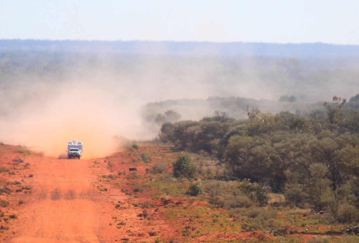
Once again I found myself at the apex of a destination triangle. Thargominda was away to the northwest and I really hate back tracking, so the Dowling Track it was. Don’t be too aghast at the name ‘track’. It can be a narrow, winding, rutted, test of endurance, but in this case something a lot more rural roadish. No need to air down and once again that red earth road base came through in the clinches. Every so often, a patch of bitumen would appear, usually on steep hills, just to give ya hope.

The hills were infrequent, but every now and then you could sweep your gaze across the endless scrub that stretched horizon to horizon. Best part of three and a half hours to cover the 175klm, but eh? Not like there’s a meeting I have to get to. Mid afternoon, I rolled into Thargomindah, a town with an amazing backstory. Talk soon..